


![]()
Distance: 8.8km (5.5 miles)
Time: 3.5 hours
Start/Finish: Car park and picnic area in the Olchon Valley (SO 288328).
Paths: Clear paths over open hilltops and down a steep-sided valley. It ends with 2km on a quiet lane.
Maps: OS Explorer Series (1:25 000) OL13 Brecon Beacons Eastern Area.
Tourist Info: Hay on Wye TIC – Tel (01497) 820144.
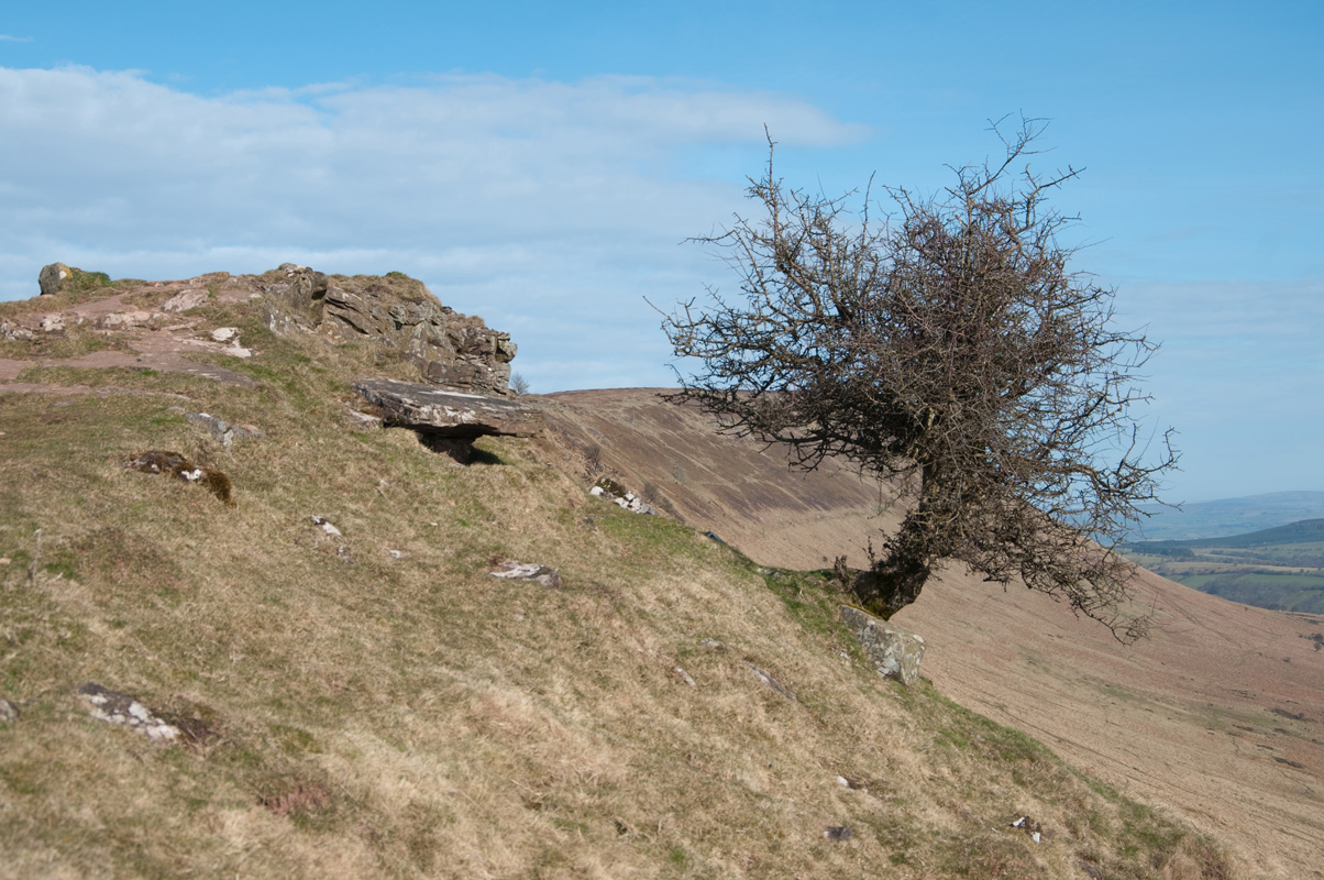
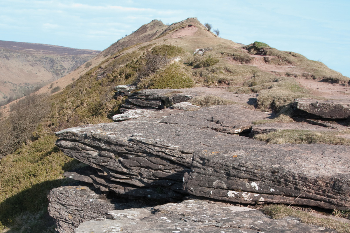
The Black Mountains are made up of a single lofty east-west ridge with a steep northern escarpment overlooking the Wye Valley. This is propped up by four north-south ridges running easily down in the direction of the Usk. The easternmost of these ridges splits in two, with the main Hatterrall Ridge carrying the England/Wales border down towards another impressive waterway, the Monnow, while a small splinter ridge points accusingly into Herefordshire. This ridge, often referred to as the Cat’s Back, due to its shapely profile, makes a wonderfully airy walkway up onto the main ridge. It can easily be combined with the Hatterrall Ridge to make a fine horseshoe walk but is even better when it’s linked with a descent next to the tumbling Olchon Brook.
Your route…
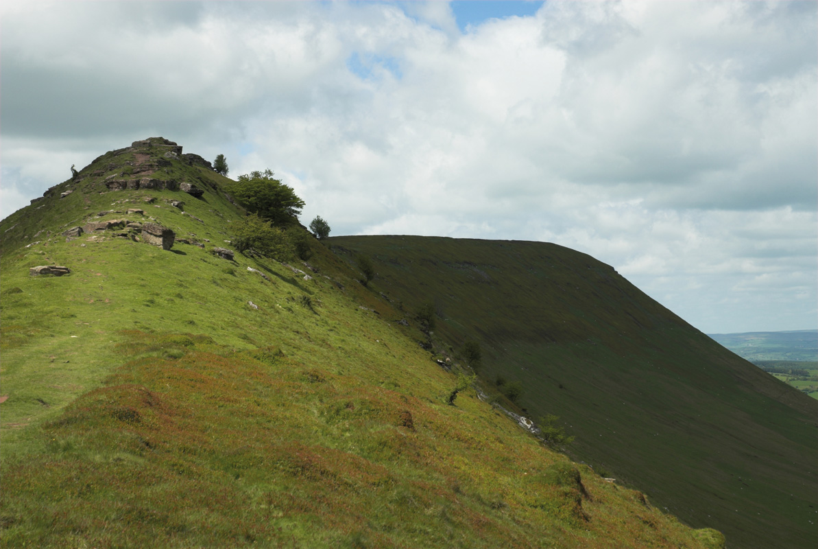
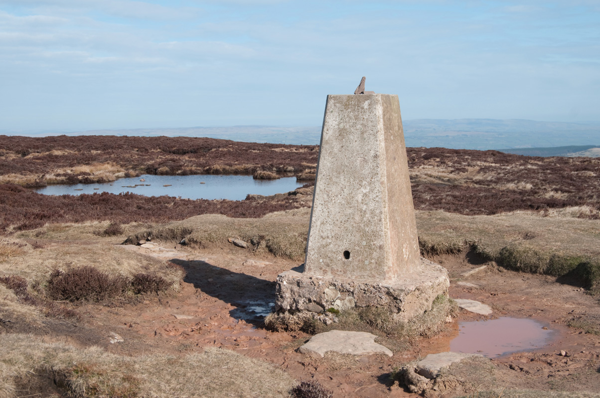
From the top of the car park, walk through the gate or over the stile onto the open hillside. Climb steeply up the centre of the obvious nose on a clear path that leads through the gorse. This eventually levels on a narrow ridge, broken by small rocky steps. Now continue easily along, rising and dropping several times, until you pass some craggy quarries and a couple of cairns. The ridge broadens here but you should stick to the eastern escarpment to follow a clear path through the heather to the trig point atop the 640m Black Hill.
Bear half left to follow a faint path away from the summit, keeping the small pool to your right. This then tracks parallel to the escarpment edge, around 200m west of it. You’ll notice the shallow head of the Olchon Valley to your left, and at its head it fans out onto a small open plateau. Continue onto this and then keep your eyes open for a faint grassy track on your left.
Take this path and follow it down to a junction with a clearer track where you turn left to follow the infant Olchon Brook down into the valley. The track broadens a little as it steepens and you’ll need to clamber down a number of steep rocky steps, with great views right over a small waterfall. You’re now looking down over the whole of the valley and the views are superb.
The track eventually levels again and becomes a lovely grassy stroll that crosses a tributary of the Olchon Brook before joining a tumbledown wall. Continue alongside the wall, crossing further small streams and passing beneath a couple of small copses. The track ultimately leads down to the road that runs up the middle of the valley. Bear left onto this and follow it easily to a T-junction after around 1.5km. Turn left here and follow the picnic area signs uphill and around to the left to return to the car park.
The most enjoyable way to descend is to retrace your steps back across Corn Du to Bwlch Duwynt, the obvious saddle between the summit and the long ridge that runs south. Alternatively, a good path runs below Corn Du, allowing easy passage with no extra height gain. To locate this, drop back into the saddle you’ve just crossed and fork left, beneath the grassy slope that leads to the summit.
You’ll reach a fairly major junction of paths where you need to locate the main track that leads downhill to your right, away from Corn Du. Follow this easily down for around 1.5km until you see the Taf Fawr River to your right. A short diversion will expose a great rocky picnic spot above a small waterfall. Continue down to the bridge at the bottom and cross to rejoin the main road.


