


![]()

The Dovey Hills are among Snowdonia’s southernmost peaks. They rise up from a steep-sided pass on the eastern flanks of Cader Idris and run eastwards for over 12km before finally dipping their toes into the Afon Dyfi, close to the village of Mallwyd. Their rounded, grassy tops seem more akin to the Cambrian Mountains further south than the rugged, rocky summits that dominate the national park to the north and west. And in common with their mid Wales neighbours, they see few footprints. Walking here is a little like going back twenty years: the paths, where they do exist, are twisting and narrow, and the summits lack the sprawling cairns, built by thousands of walkers ‘just adding a stone’, that crown the larger peaks. The scenery is just as breathtaking though, particularly in the centre of the range where a steep escarpment drops precipitously from the highpoint of Maesglase. This walk explores this area.
Head up the lane opposite the lay-by and continue easily past houses, with great views up to Maesglase, until the lane starts to dip to the valley floor. Here, turn left through a gate onto a broad grassy track and follow this through a succession of fields and beneath a small plantation. At the end of the wood, cross a ladder stile onto open ground and continue past ruined buildings. Now follow the faint path as it zigzags up the steep slope to Bwlch Siglen, the deep saddle between Maesglase and Foel Dinas.
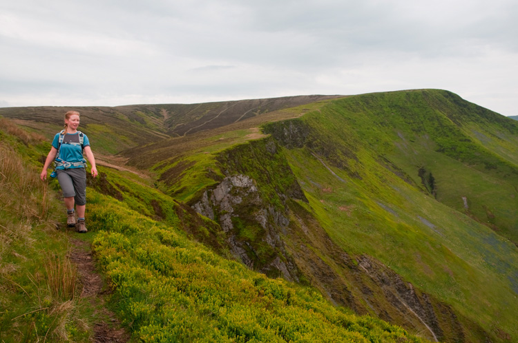
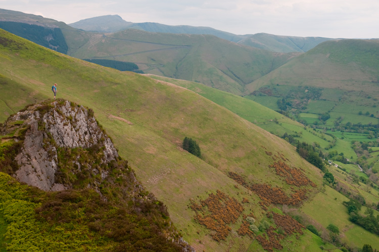
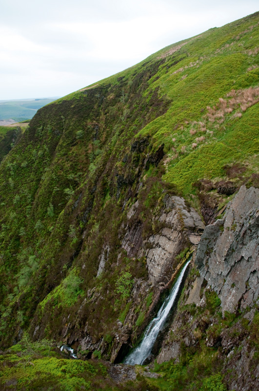
Turn right here and follow a narrow path that snakes up the bilberry covered hillside, crossing a stream near the top. Now keep right to follow the trail along the rim of Craig Maesglase, with wonderful views down over the valley below and also north towards Aran Fawddwy. The path, which is peaty and boggy in places, eventually dips to cross the Nant Maesglase, just above the dramatic waterfall that was easily spied from the walk in. A grass-topped pinnacle nearby offers a dramatic viewpoint for the waterfall and the surrounding hills.
Bear left once over the stream, and follow the path as it climbs easily towards the sharp promontory that appears to be the summit. Once above this, it’s clear that another short climb is in fact needed before the 674m summit, marked as Maen Du on the map, is actually reached. Cross the stile here and then turn right to follow the fence steeply down into the deep saddle below.
A tree stump acts as a makeshift stile to climb back over the fence at the lowest point, and from here, pick up an obvious grassy track that sweeps diagonally down the hillside – actually a permissive path. Follow this down and around the eastern tip of the hill, and then continue through a succession of gates until you reach the buildings at Ty’n-y-celyn.
Go through the gate and bear right at the fingerpost to walk down a track towards some large barns. The barns seem to block the actual line of the footpath here, so the best bet is to swing left and then right to follow the drive down to the road. Turn right here to walk along the verge back to the start.
Distance: 5 Miles (8km).
Time: 4/5 hours.
Start/Finish:Lay-by NW of Dinas Mawddwy SH847154
Paths: Mainly faint and narrow tracks over high mountains. Some boggy sections.
Maps: OS Explorer Leisure Series (1:25 000) 23.
Nearest Town: Dolgellau.
Tourist Info: Dolgellau – Tel: (01341) 422888.


