![]()
As Snowdon becomes increasingly popular, so the surrounding mountain ranges start to feel more and more remote, and nowhere is this more apparent than in the Moelwyns, where it’s still possible to walk for hours without seeing a soul. This walk makes a logical and reasonably easy round of the peaks at the southern end of the range – Moelwyn Mawr and Moelwyn Bach – and, whilst it catches the remote and wild flavour the massif is famous for, it follows mainly clear paths making it an ideal introduction to the range. The opening leg climbs the mighty Moelwyn Mawr via its shapely west ridge. It starts easily enough but becomes rougher the higher you go. The middle section links the two Moelwyn peaks via a ‘scrambly’ path that hurdles a minor peak along the way. This is followed by a steep and airy walkway that leads onto Moelwyn Bach. The descent is about as kind as it could be: soft underfoot and with fine views west over the sea.
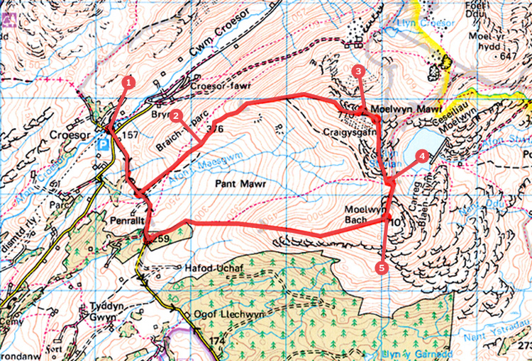
Turn left out of the car park and walk straight across the crossroads to climb the lane opposite. Go through a gate and continue into a dip before climbing up again. Continue until the gradient briefly levels and here go through an unmarked gateway on the left to follow a broad track easily upwards. Go through another gate and continue until the track drops steeply to the right. Now turn half left to follow a faint path uphill to a gate in a fence.
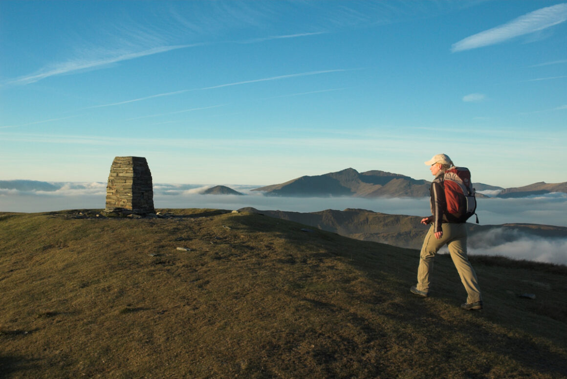
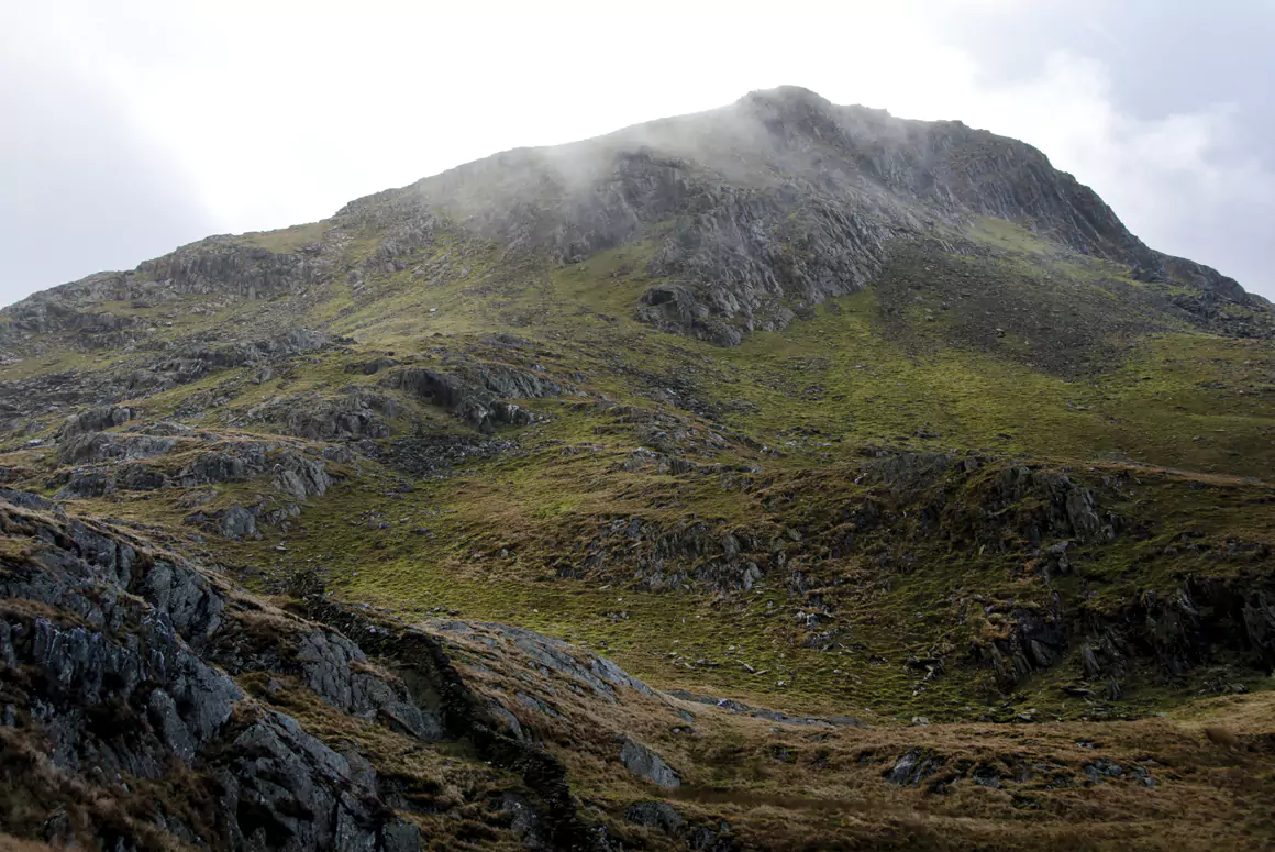
Go through this and continue up to the crest of the ridge above. Turn right to follow the crest up until you reach a ladder stile. Cross this and bear right to continue upwards, staying as close to the crest as you can. You’ll shortly pass a few old mine ruins before dropping down again into a deep saddle beneath the steep final slopes. Continue ever upwards, and as the gradient eases again keep to the left to regain the crest of the ridge, now with wonderful views up to the summit. Follow the ridge easily to the trig point, where you have fine views in all directions.
To descend, keep straight ahead (east) on a faint path that leads through longer grass. This leads to a smoother patch after 100m, where you should turn right (south) to locate another path that now drops through rocky outcrops into the deep saddle beneath Craigysgafn. Cross this path and continue straight ahead to scramble easily up to the summit of Craigysgafn, which has great views over both the Moelwyn Peaks. Keep ahead again to drop into another saddle that lies at the foot of Moelwyn Bach.
From here it’s easy to see a narrow path that heads steeply up from the saddle, gradually traversing diagonally across the hillside. Take this and cross a band of scree before continuing onto a grassy shoulder close to the summit. This is crowned with a few narrow rocky bands and a small cairn. The views back to Craigysgafn and Moelwyn Mawr are superb.
The homeward leg is a delight. First locate a faint path that leads from the cairn down onto the crest of the ridge and then follow it easily down for nearly 2km, eventually forking right, near the bottom, to aim for the right hand corner of a plantation. Continue through the gate and along the side of the wood to the road. Turn right to return to Croesor.
Distance: 6 Miles (9km).
Time: 4/5 hours.
Start/Finish: Free car park in Cwm Croesor SH632447.
Paths: Mainly clear paths over high mountains. Some steep sections where hands are required.
Maps: OS Explorer (1:25 000) OL17 & OL18; OS Landranger (1:50 000) 1111111115 & 124 Harvey Superwalker (1:25 000) Snowdonia West.
Nearest Town: Penrhyndeudaeth.
Tourist Info: Porthmadog TIC – tel. (01766) 512981.


