


![]()
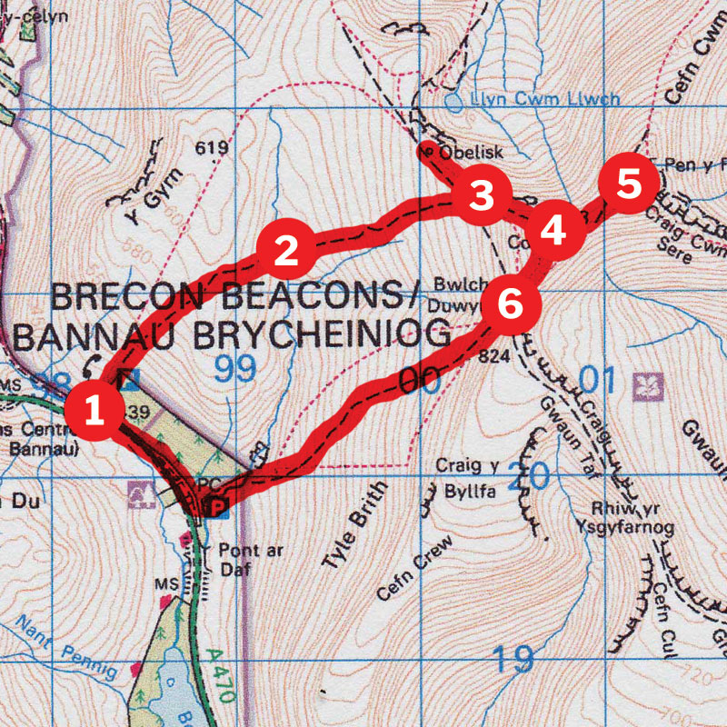
Distance: 8.5km (5.5 miles)
Time: 3 hours
Start/Finish: Storey Arms SN982203.
Paths: Clear paths over grassy hillsides.
Maps: OS Explorer Series (1:25 000) OL12
Tourist Info: www.breconbeacons.org/discover/visitor-information
I pilgrimage to the summit of Pen y Fan – the Brecon Beacons highest peak – it’s a must for all walkers and there’s a wide range of routes to get to the top and back. This is the easiest and shortest, and therefore the most popular. But this doesn’t detract from the experience at all; it still has a big mountain feel once you’re away from the road and the usually teeming car park. It is possible to do this and a straight out and back walk, but the circular version featured here offers a lot more variety for very little effort.
Your route…
Cross the road and hop over the stile next to the telephone box. Follow a clear, in places man-made, path up the hillside, leaving the plantation behind and crossing the open moorland of the southern flanks of Y Gyrn – a rounded summit to your left. You’ll soon gain the ridge and cross a stile to drop easily down to the infant Afan Taf Fawr.
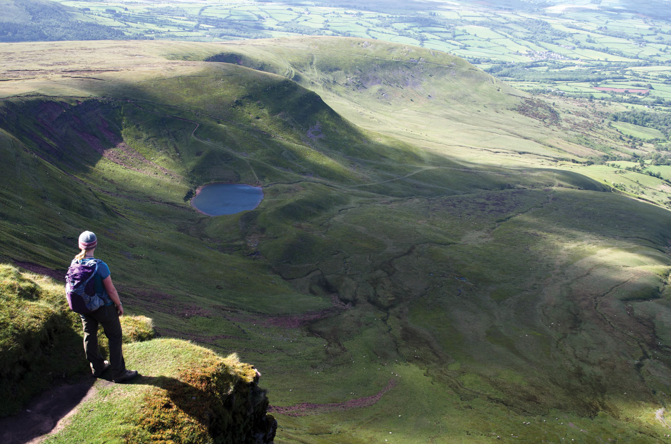
The way ahead is clear now and you’ll see the track ahead climbing steeply up the hillside opposite. Follow this until it reaches escarpment edge above Cwm Llwch. Below you, you’ll see the glacial formed lake of Llyn y Cwm Llwch and above this, the steep head wall that unites the twin peaks. At this stage it’s worth turning left and walking downhill for a few steps to the touching Tommy Jones Memorial.
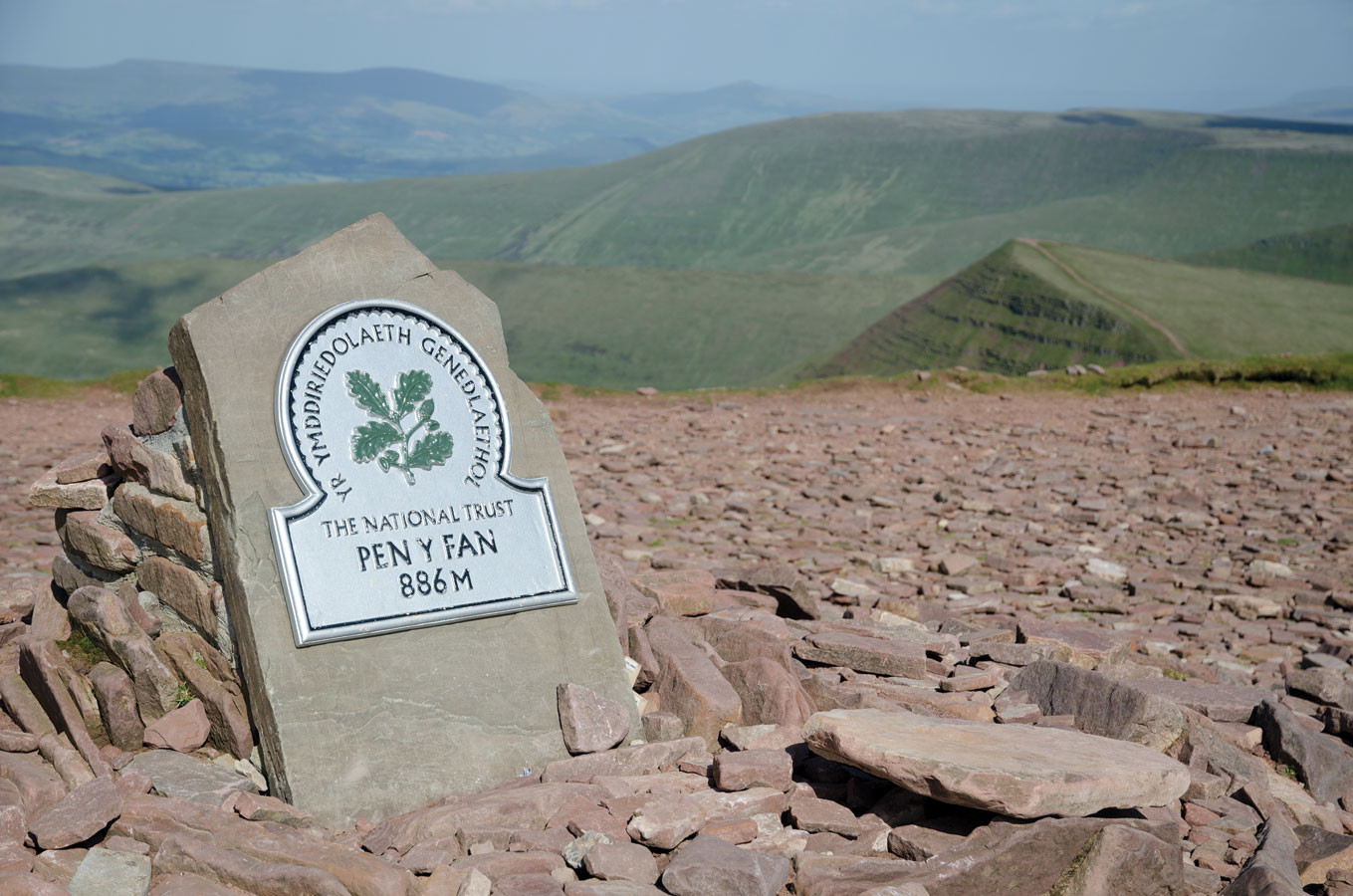
Now retrace your steps back up and follow the clear path up onto the rocky ramparts of Corn Du. The path slips easily around the craggy outcrops and leads you up to the huge cairn atop the broad summit plateau. The views down the valley are awesome but take care; some of the summit rocks pretty much overhang the chasm below. The way to Pen Y Fan is obvious from here.
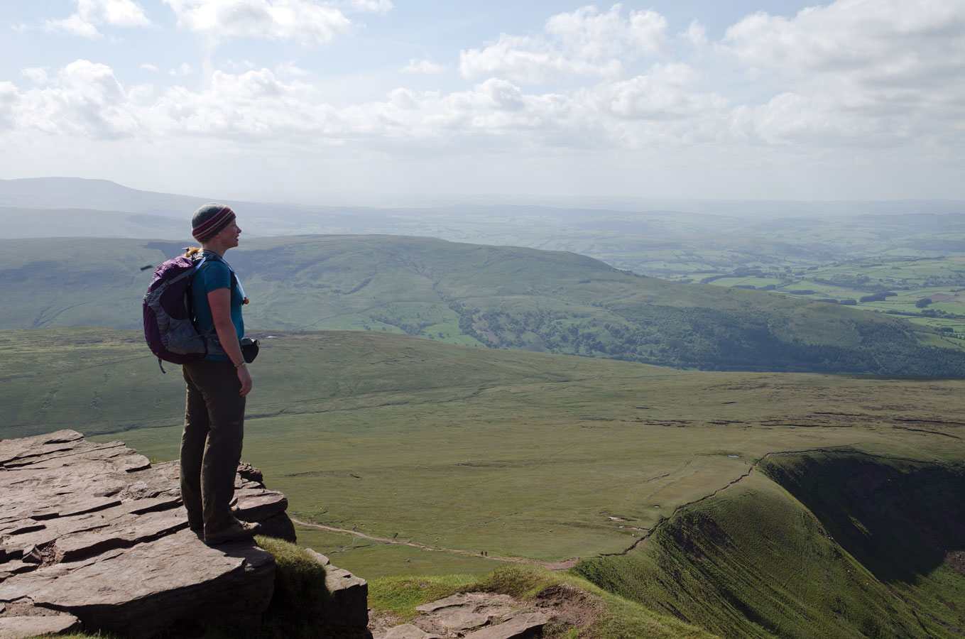
Drop into the shallow saddle to the east and continue easily onto the summit. This opens up a whole new vista with the narrow ridge of Cefn Cwm Llwch acting as the dividing wall for the remote Cwm Sere, to the right as you look out. The north-east face of the mountain is particularly precipitous so again, take care near the edges.
The most enjoyable way to descend is to retrace your steps back across Corn Du to Bwlch Duwynt, the obvious saddle between the summit and the long ridge that runs south. Alternatively, a good path runs below Corn Du, allowing easy passage with no extra height gain. To locate this, drop back into the saddle you’ve just crossed and fork left, beneath the grassy slope that leads to the summit.
You’ll reach a fairly major junction of paths where you need to locate the main track that leads downhill to your right, away from Corn Du. Follow this easily down for around 1.5km until you see the Taf Fawr River to your right. A short diversion will expose a great rocky picnic spot above a small waterfall. Continue down to the bridge at the bottom and cross to rejoin the main road.


