


![]()
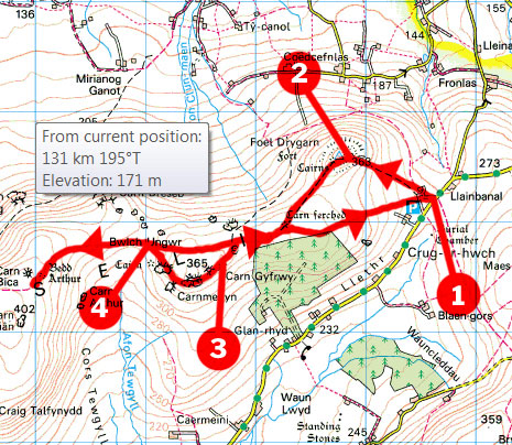
The Preseli Hills form the only real inland tract of land in the Pembrokeshire Coast National Park, and as such are often overlooked by visitors who flock to the area primarily for the wonderful coastline. Yet the hills are an amazing place to walk, with spectacular scenery and huge views. They also have a few tales to tell: the biggest of which is centred on Carn Menyn, a jumble of huge dolerite stones, which supplied the magnificent bluestones that now grace the centre of Stonehenge. Why or how they were transported, nobody knows. This is an easy walk, and it does retrace itself in places, but it’s without a doubt the best way to explore the major landmarks of the hills without making a straightforward out and back.
Head west along the lane until you reach an obvious hedged track on the right. Take this to a gate at the top and continue across open ground for another 100m or so, where you need to fork left to follow a faint grassy track up towards the summit of Foel Drygarn. This gets clearer near the top and eventually leads to the ugly concrete trig point, sat among the piles of stones that give the mountain its name – Foel Drygarn means rounded hill with three cairns. The views are wonderful from here and you should be able make out the whole walk as well as the Pembrokeshire Coast.
Follow the faint path between crags on the southern flanks of the hill and aim for the eastern corner of the plantation ahead – warning: attempts to cut the corner will end up with wet feet. At the wood, you’ll meet a good track, which is actually the old trade route that runs along the whole ridge. Turn right onto this and follow it westwards away from the wood. As you leave the wood behind, you’ll climb steadily to a large rocky outcrop with a circular sheepfold at its base.
Bear left here and follow a faint path towards Carn Gyfrwy, the next big outcrop. Now continue around in a semicircle linking the whole series of weathered rocky clusters via a faint path. Carn Menyn, the provider of the bluestones to Stonehenge, is the very lowest of the bunch, perched precariously on the edge of the steeper western escarpment, close to the saddle of Bwlch Ungwr. From these stones, drop into the saddle where you’ll once again meet the main ridge track.

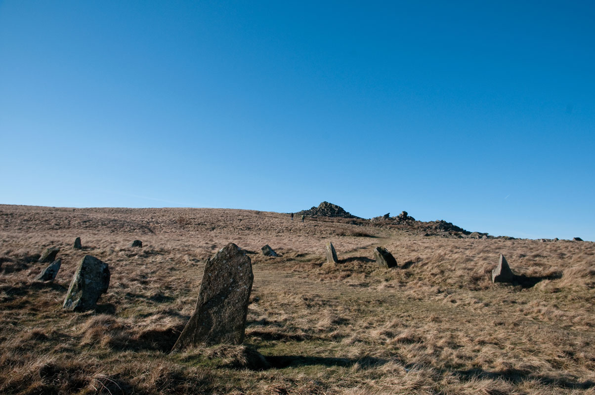
Turn left onto this and climb towards the obvious rocky tor on the skyline, Carn Bica. The path splits near the top and you need to fork left to the stone circle of Beddarthur, or Arthur’s Grave, which sits just south of the tor. This is one of many spots in Wales where the legendary king is said to be buried – it’s certainly a magical spot. From here, carry on up to Carn Bica – another fine viewpoint – and then turn around to retrace your steps back into Bwlch Ungwr. Now keep straight ahead and follow the main track back past the stones you looped around earlier, to the corner of the wood. Keep straight ahead to the gate and retrace your steps back to the car.
Distance: 5.5 Miles (9km).
Time: 3 hours.
Start: Lay-by, Llainbanal SN165330
Paths: Mainly clear paths over grassy hillsides, but one or two vague sections and a couple of boggier bits.
Maps: OS Explorer Series (1:25 000)) OL35 North Pembrokeshire.
Nearest Town: Cardigan.
Tourist Info: Cardigan TIC (01239) 613230.


