


![]()
As Wales comes slowly out of lockdown and it’s once again possible to get into the mountains, it will definitely be worth choosing your objective with care. Some paths and areas will remain closed longer than others, and some that are open will become the new honeypots, with the existing ones out of the game. Arenig Fawr is unlikely to ever be busy, even though it’s an impressive peak and this is a wonderful mountain walk. Choose a good day – it’ll make things a lot easier as well as more spectacular.
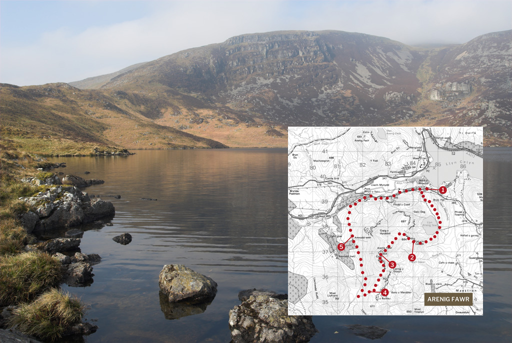
Go through the gate and follow the track up and around to the left. As it breaks hard left, keep straight ahead on a pleasant grassy track and follow this easily up to Llyn Arenig Fawr. Walk across the dam and cross the outflow before striking left, then right to follow the broad ridge west. This leads to a fence which can be crossed by stones.
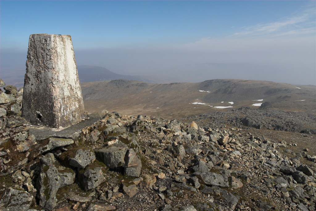
Continue easily into Bwlch Blaen-y-nant, where you get views across to the Moelwynion, Snowdon, Y Glyderau and Y Carneddau. Then follow the path leftwards to cross a lot of rubbly ground, all the time climbing easily towards the summit of Arenig Fawr, now clearly visible. After a final steep section you’ll reach the trig point, shelter and memorial plaque dedicated to the 6-man crew of an American Flying Fortress, who lost their lives when the plane came down in low cloud on the 4th August 1943.
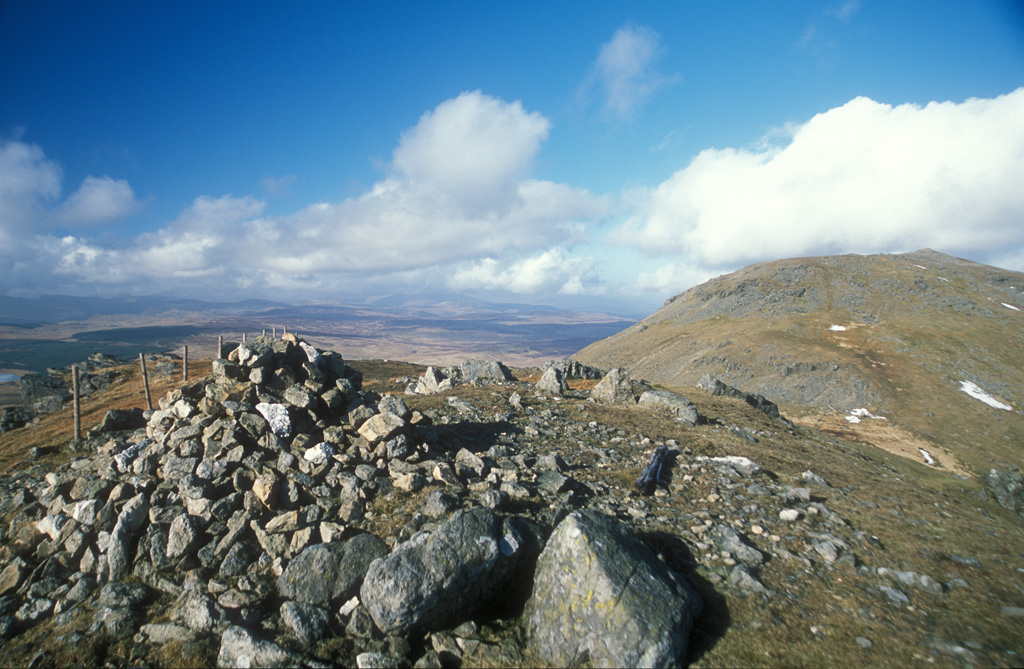
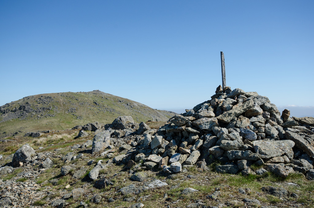
Keep ahead to drop easily into the next col and cross a stile, keeping the fence to your right, to climb easily to the South Top, which offers great views back to the main summit. Now continue in the same direction with the fence still to your right and drop into a broad, boggy col before climbing slightly past a succession of scenic tarns.
As the fence meets another, bear right, and follow it down into the valley below, now keeping it to your left the whole time. Once you reach the saddle, bear right and drop to pick up the head of a clear track. The going is pretty easy from here. Follow this down to a junction and a gate that leads into ruins at Amnodd-wen and take the higher of the two tracks from here.

Continue along the wall on a boggy, sunken track. This passes another derelict building before crossing a stile into a particularly boggy area. Stepping stones and sleepers lead to another stile where things get easier. Continue to a small disused quarry and bear right to follow the upper track around the hillside and into a large quarry. Keep ahead to continue easily out to the road and turn right to follow it back to the car park.
Distance: 15km (9 miles)
Time: 6/7 hours
Start: Pull-in on minor road, south of Llyn Celyn (SH846396)
Paths: Clear tracks, faint mountain paths and some untracked hillside. Boggy in places.
Maps: OS Explorer Series (1:25 000) OL18
Tourist Info: Bala TIC (01678) 521021


