


![]()
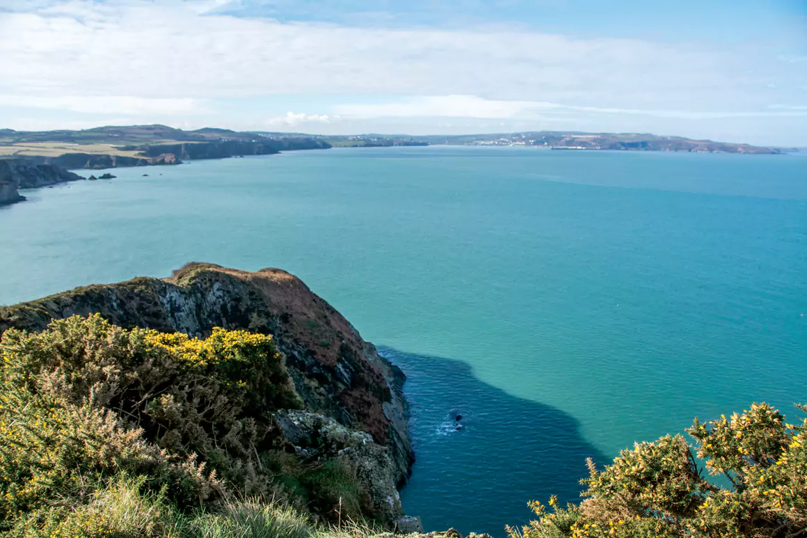
Dinas Island isn’t actually an island in the true sense of the word, it’s actually a rocky headland separated from the Pembrokeshire mainland by a narrow, marshy channel. Despite its diminutive area – this walk circumnavigates the whole headland in just 3 miles – it is still a significant landmark on the Pembrokeshire coast; rising to 142m at its highest point, and acting as the dividing line between Fishguard Bay to the west and Newport Bay to the east.
Distance: 3 miles (5km)
Time: 2 hours
Start & finish: Car park at Pwllgwaelod SN005399
Paths: Mainly narrow coast path above steep cliffs.
Maps: OS Explorer Series (1:25 000) OL35 North Pembrokeshire
TIC: Fishguard 01437 776636
Your route
Walk back out the car park the way you came in and turn right to pass the beach and follow the drive up to a sharp right-hand bend, where you keep straight ahead onto the coast path. Navigation couldn’t be simpler from this point onwards, just follow the path up and around, as it crosses above a succession of small bays, towered over by impressive cliffs.
The path turns eastwards above Cafnau and now offers fantastic views across to the high point of the walk at Dinas Head. Continue easily now to the trig point, which is a wonderfully airy spot with fine views in all directions.
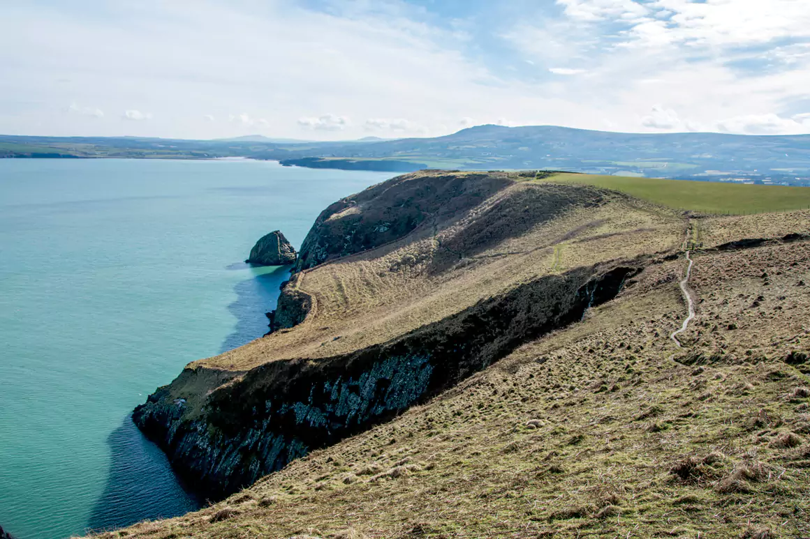
From the top, continue around the northern tip of the island and start dropping, passing above Pwll Glas before arriving at a gate. Pass through this and bear left to drop steeply down on a lovely, but narrow and quite exposed section of path. Follow this along, eventually crossing a shoulder with the sea stack of Needle Rock beneath you. This is an amazing place in spring, with a huge colony of guillemots and razorbills occupying every small ledge. You’ll probably hear them before you see them.
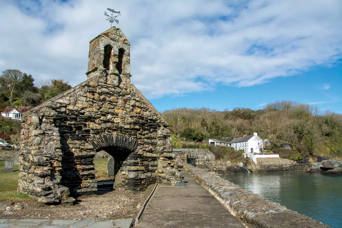
Continue around again, and you’ll eventually start to drop south towards Cwm-yr-Eglwys. The path winds easily down through woods, eventually emerging on a lane. Keep left to pass cottages and then swing around the right, where you’ll see the haunting ruins of St. Brynach’s Church. The rest of the building was destroyed in a fearsome storm on the 25th October 1859. It was one of the worst storms on record, destroying incredible 114 ships in one night.


Take a footpath on the right, keeping the boat yard to your left, and walk through a car park and onwards through a caravan site. This then turns to a pleasant tarmac path that cuts across the neck of the headland and delivers you back to Pwllgwaelod.
Words & Pictures: Tom Hutton
First published in Welsh Country Magazine May-Jun 2018


